Sunday, July 25, 2010

Blue Angel Birthday

     Monday is Rick's birthday and I was worried that it would not be a fun day, what with trying to get the part for the trailer and get it installed.  So today, Sunday, I thought that we needed to do something fun.  We decided to drive to Idaho Falls  and stay overnight so that we can pick up the part in the morning and then drive back.
    Our drive to Idaho Falls took us past the Idaho National Laboratory which is an 890 square mile complex located in the high desert land between Arco and Idaho Falls.  There are a number of facilities within this area.  We could see little sites stuck out in the desert.   On July 17, 1955 the town of Arco (where the campground is) was the first community in the world ever to be lit by electricity generated by nuclear power, from a reactor at the Idaho National Laboratory.   It is a really weird and interesting area.  
  We are staying in Idaho Falls right on the Snake River in a Hilton Garden Inn.  It is a gorgeous (senior discount) suite with a balcony overlooking the river.  After an amazing soak in a jacuzzi tub, I sat out on the balcony and zoom - two Blue Angel planes buzzed by.  I hollered at Rick and got the camera.  There is an air show at the airport just a mile away.  For the next 90 minutes we saw wonderful air acrobatics as the planes flew out over the desert, down the river and then back over the airport.  It just sent chills up my back.  I told Rick that it was his birthday treat!
    We had a nice dinner and a walk along the river.  Very pretty.   We are trying to recharge because things are not looking good yet for tomorrow.  We still have no mechanic to install the part.  We called our Good Sam trailer insurance - they have no solutions until tomorrow either.  So, we sit out on our balcony, watch the swans in the river and forget about tomorrow.

Saturday, July 24, 2010

Arco, Idaho

     So here we are at Arco.  A bit in the middle of nowhere.  We tried not to worry last night and to just wait until we could call someone today.  An RV place in Idaho Falls told Rick they can order a new leaf spring and have it on Monday.   The parts place is closed for the weekend.  We made an appointment to have it installed at the RV place after we pick up the part.  However, we have the name of someone here in Arco who could install it without moving the RV, but he is fishing for the weekend so we need to wait to call him tomorrow afternoon.
    With nothing to do but wait, Rick decided to wash the bugs off the RV.   Usually this is not allowed in campgrounds, but they feel sorry for us AND thought the grass needed some water.  I started sorting through things that will need to be unloaded from the RV when we get home (eventually).  I also found some time for a swim in the nearby pool and some reading in the lounge chair - pretty nice actually.
   Our campground hosts also told us about events taking place in the area.  One was a hang gliding contest in a town about 15 minutes away.  With a little meandering we found the spot where we could see a dozen or more hang gliders soaring very high above the hills.  Several cars and trucks were there providing support to some of the teams and watching them launch. 
    The support guys told us about the weekend event and about hang gliding in general.  Some of the contestants can glide for over 100 miles.  We watched them work their way from a launch site halfway up the mountain - back and forth on the thermals.  It was like an air ballet.  One of the less experienced gliders just couldn't get up high and came lower and lower until he landed in a nearby field.  Pictures from this competition will be in Sports Illustrated in a couple months.  Cool!
    Then back to the RV for another Skype call to Carter and his family (that's how he thinks of it).  We saw Bennett crawling and grabbing at his brother Carter.  Carter is showing very sweet patience with his little brother as he grabs his hair and ears.  What a sweetie. 
    Well, tomorrow we see if we can contact the mechanic to do the work.

Craters of the Moon - Oh, Oh!

     First: we have a broken spring on our RV.  Rick noticed that the wheels on the right side of the trailer were very close together - almost touching.  He climbed under the trailer and saw that the leaf spring was broken.  It is Friday and after 5pm in an area where no one works on weekends.  The campground owner gave us some places to call.   He also looked at the RV and said that he thinks we shouldn't drive it to Idaho Falls which is 70 miles away.  We will make calls tomorrow.  We'll see.
     The day started out nice.  We had an easy drive across the southern part of Idaho from Boise to Arco, Idaho.  We put our RV into a campground and then drove back to Craters of the Moon National Monument.  This is a 750,000 acre area covered with craters, cinder cones, lava tubes, fissures, caves and rifts.  There are some paved walking trails, hiking trails and a  larger area that can be used by 4-wheelers.  Some sections are covered with huge piles of very rough lava, some smooth, almost glassy, flows of hardened lava, and piles of cinders which are now growing wildflowers.  Other areas have trees, sagebrush, and wildflowers.  It was hot and very, very windy.  We were told that this was one of the cooler summer days.  We are at 6000' though, so the temperature should drop a lot by early evening and be very cool by morning.
    We spent a couple hours at Craters of the Moon and then returned to the campground.  We were planning our drive home and when Rick went to the truck to get the maps he noticed the odd closeness of the tires.   He came in with a very deep sigh and said that we have other issues to deal with due to the broken spring.  The tires are already a bit worn from rubbing together so we aren't sure how long ago the spring broke.  Maybe today, maybe a week ago.  Ah well, at least we are not worrying about getting back to work. 

Friday, July 23, 2010

Boise, Idaho

     Despite the hot day yesterday it was a beautifully cool night and a pretty morning.  We did our last bit of shopping for the trip home and Rick got a very needed haircut.  After lunch Uncle Bud picked us up for a tour of Boise.  We went to the capital building which is recently remodeled.  Cousin Don works there as the head state legislative auditor.  We didn't see Don, but we had a grand tour of the building.  Downtown Boise is a very attractive city.  The whole area has grown dramatically since we first came here to visit in 1970.
     We drove out to one of three reservoirs on the Boise River.  The more time I spent with Rick and his uncle, the more that I knew I was looking at Rick in 15 years.  The two of them have similar walks, slump when they sit,  and think the same things are interesting.   We just had a great time visiting with him.  After dinner we spent time with Bud's other son, Greg, and his family.  It has been good to see everyone.
    Uncle Bud and Aunt Margie were our idols when we were getting ready to retire.  They owned a series of trailers and spent 7 years traveling around in them.  We have had fun trading traveling stories.  It is clear to us that there are "travelers" and "non-travelers".   Bud said that he never felt so free and relaxed as when he was traveling around the country.  Bud said, "When you carry your bed, bath and bar with you you are ready to go anywhere."   We agree.  We inch closer to home tomorrow as we drive through southern Idaho.

Thursday, July 22, 2010

The Longest road in the US

     U.S. 20 goes from Boston, Massachusetts, to Newport, Oregon.  We have driven on it several times as we wandered through Oregon.  It is the longest road in the U.S.  Today we drove from Burns, Oregon to Boise on U.S. 20.  Our Boise relatives tell us to say Boi se' not Boi' zee and that we just came from Oregun not Oregone.  Otherwise we are speaking "Minnesotan."
     The section of US 20 from Burns to Vale travels through some very bare hills and then along the Malheur River valley.  Pioneers traveling West on the Oregon Trail were always looking for shortcuts.  Although this valley is now heavily irrigated and green along the river, the western sections are dry except where they touch the alkali lakes and lake beds.  This route became known as "The Terrible Trail" as many pioneers died while using this high desert cut through the mountains.  We met up with I84 at Vale.  Usually the Pioneers turned north at this point after crossing the Snake River - another river crossing which was very treacherous and killed many pioneers who had survived the long journey from St. Louis.  We made the crossing without incident and stopped for a nice picnic lunch at a rest stop before heading into Boise.  We are now on Mountain time - closer to home.
     After a brief GPS failure due to a recently changed one-way street and the need to turn around in a parking lot we got to the Meridian / Boise KOA. This urban campground is not picturesque, but it is very clean, has a pool, some grass and flowers, and 15' trees that provide bits of shade.  It is hot here, but not over 100 as it was the last time we visited Boise.  We don't have the most powerful air conditioner, but if we close everything up tight, put insulated covers over the skylights and pull down all the darkening shades the air keeps it reasonably cool until the sun sets and the temps drop in this really dry climate.
     Uncle Bud picked us up at the campground in his new red Camry for dinner and a visit with Rick's Boise cousins.  It was great to see them again.  By the time we returned to our RV the moon was up, the breeze was cool and we could open all the windows to a lovely evening.

Tuesday, July 20, 2010

The Oregon Outback

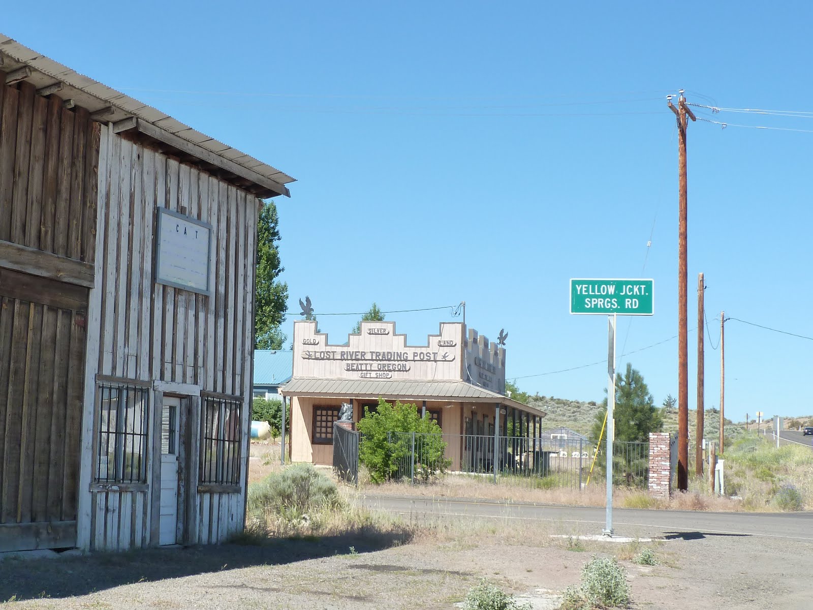
     We left Klamath Falls today and took another scenic Byway call the "Oregon Outback."  We are headed to Boise with a stop tonight in Burns, Oregon.  The first part of our drive on Oregon 140 took us through a farming/ranching area.  Corn, potatoes, and lots of hay.  It was pretty with some nicely rolling hills in the background.  The only sour note was the fact that most of the hills were barren or had stubby little pines trying to regrow a forest after the heavy cutting.  We made a stop in a small town for a quick break - see the attached picture.  It seemed like the end of the road. 
    We then caught Oregon 395 and headed NE.  There was a big lake (Abert) on the map, but I wasn't seeing anything that looked like lake country.  Then we saw it - a huge milky green sheet between shores of white alkali and sand.  Not like our pretty Minnesota lakes.  The road ran between the lake and Abert Rim, a steep escarpment that rises about 2,500 feet above the lake surface  We followed the lake for 15 miles.   The road then went into a high desert area that was all sage brush and rock.  This area is part of the "Great Basin" which includes southern parts of Oregon, most of Nevada and bits of Idaho, California, New Mexico and Arizona.  In the midst of all the sand and dust we saw one little spot with trees.  It was a "rest stop" with picnic tables and shade.  We stopped for lunch and talked with several other travelers who were amazed at the landscape and the lack of all amenities on this road.  Good thing we had stopped for gas when we left Klamath Falls.
     The more we drove the more it felt like we were back in Nevada - my most unfavorite state.  At any rate, most of the drive was easy and we finished the day in a tiny campground with huge shade trees.  We are still pretty high - 5000' so it is supposed to get cool tonight.  Always nice to be able to open the windows and shut off the air conditioning.  We have a big grassy lawn and only a few neighbors.  There is a field behind the campground full of horses.  This is my kind of camping.

Redwood Scenic Byway

     Our trip started in fog again this morning as we drove back up US101 to catch OR199 going east into Oregon.  The sun was out on the ocean for a short stretch so we had a chance for one last good look at the Pacific before we caught the road  called the Redwood Highway.  In places the big old trees grow within a foot of the road.  Some of them have chunks cut out so they won't catch on passing trailers and semi's.  The road is very dark  under the tree canopy and then very bright in the open areas - the sunlight and shadows are beautiful, but very hard on the driver.
    We followed the Smith River again for a long ways.  The water is very clear and I could see the rocks at the bottom even when the road was far above the water.  After a winding climb into the hills we came to Oregon's longest tunnel.  (A couple days ago we did the highest bridge in Oregon). I had already looked on the Internet to be sure that it was tall enough for us.  At the end of the tunnel we were out of the redwoods and had a nice drive to I-5. 
    Our GPS had routed us on Oregon 66 from I-5.  Rick had routed us on Oregon 140.  We have a book that is a directory of mountain roads which tells us how high the passes are, how steep the grades, and any other critical road conditions.  Oregon 66 was described as having three passes, but none of them were very high and the grades were not unusually steep. The pavement was described as smooth, but some of the road had sharp curves.  Sounded OK, so we decided to go with the GPS suggestions.  HMMM.  The road headed up through grassy foothills.  It became steep, winding, and was without shoulders or guard rails.  Hairpin turns, wavy road, crumbling edges.  Some curves were 15 mph curves.  Some places I could see down hundreds of feet with nothing but a bit of road between me and the bottom.  Rick drove very intently and I held my mouth shut so I didn't gasp or groan.  I was hoping he wouldn't have a sneezing fit.
    Eventually we found ourselves driving in high desert with ponderosa pines.  The road was still very curvy, but the dramatic drop offs were gone.  We got to the town of Klamath Falls (there are no falls) and checked into our campground.  This side of the Cascades is much warmer.  It is 88 instead of 68 here.  We didn't have a reservation so we are parked next to the trash dumpster.  But we ARE parked, Rick can catch a little relaxation, there are some nice tall trees and a good breeze.  This was a drive for our personal record books.   Time for a glass of wine and brats on the grill.

Sunday, July 18, 2010

Stout Grove Trail, Jedediah Smith Redwoods State Park

    The coast redwoods are protected by several California State Parks and a National park.  The various park entities work together to publish maps, manage trails and eradicate old forest roads.  Today we drove on a very old road through ancient groves in Jedediah Smith Redwoods State Park.  It was a very foggy morning and chilly.  The road started out paved, went up around a bunch of sharp curves until it was at the level where the redwoods thrive, and then suddenly became narrow and dark.  The dirt road wound between 1000 year old redwoods.  Sometimes the space between the trees was only inches wider than our truck with its big mirrors.  Few cars were on this road so it was very quiet.  We drove slowly among these ancient trees in absolute awe.
    We stopped at a trail head into the Stout Grove of giant trees and walked down the silent path.  The fog drifted among the tops of the trees.  The Smith River runs along the grove and the rich soil from the flood plain has contributed to the growth of these colossal trees.   Each time we were amazed by a tree we saw another one that was even more amazing.  There is no way to describe the experience of looking up and up and up to the top of these massive trees.  They have a presence.  They seem to breathe.  They are so alive.  I love big trees. 
   On the way back to camp we stopped by the ocean and found another rock covered with sea lions.  There was a little patch of beach that was sunny.  We watched the waves and enjoyed the birds and sea lions and said goodbye to the Pacific.  Tomorrow we may catch a glimpse of it as we turn east and start the trek home.  We talked with our children and grandchildren on Skype after we returned to the RV.  We still have some fun things to do on the way back, but my traveling heart is starting to think about home.

Saturday, July 17, 2010

Redwoods National Park, California

     I love the ocean, I love big trees.  Today I had both.  The coast redwood is the tallest living tree.  It can grow to nearly 370 feet.  Only 4% of the Coast Redwoods remain in forests in southern Oregon and northern California.  The giant Sequoias that we saw a couple years ago can grow to a diameter of over 40 feet but are not as tall - up to 311 feet.  Coast Redwoods are slimmer at a diameter of 22 feet.  We certainly saw some big ones today.  It was just funny to see so many people walking around staring up and trying to take pictures of something so tall.
     We went to the southern section of the park and drove another scenic parkway through a corridor of huge trees.  We stopped several times just to get up close to the trees to really appreciate the awesome size.  At Big Tree Wayside we saw one that was 304' tall with a 21' diameter.  Wow!  There were many other biggies in the old growth grove.
     We stopped at two Visitor Centers as we usually do to get more information about the park.  Kuchel Visitor Center is right on the ocean which was NOT fogged in today so we spent some time enjoying the waves and the brown pelicans.  The ocean floor was much steeper here so the waves were coming in with some big booms. 
     There were many warning signs about "sneaker waves" which are much larger than the usual waves and can grab you off your feet even if you are standing on dry beach.  Four people have died at that beach since 2004 due to these waves.  We were told to never turn our backs on the waves.  We looked for the sneaker waves but didn't see one.
    Our afternoon was spent driving up Bald Hills Road 3000 feet into the foothills above the park.  It was a steep drive (15% grade) at times, but brought us to some beautiful old growth groves as well as into some high prairie areas with views of the ocean and the forests on the hills. 

Friday, July 16, 2010

Into California

     As we drove the last bit of coast in Oregon I have already planned to come back.  Each bit that we see is more spectacular than the last.  We have been staying in the state parks.  If you don't come in a camper you can stay in a "Yurt."  I think the reservations for these round tents on platforms would be hard to get at the last minute, but they look very comfy.  We also saw dozens of nice motels on the beach (as well as a lot of crummy ones).  We may not drive all the way back with an RV, but we really want to return.
     Highway 101 followed the shoreline very closely as we drove south from Bandon.  We kept stopping to look at the endless, sandy beaches that were nearly empty.  However, as soon as we passed into California the view became junked up with crummy trailer parks, old motels and lots of houses hanging off the cliffs overlooking the beach.  I think that Oregon has done so well in making this treasure of a coastline accessible to everyone.
    We finally got to Crescent City where the Redwood National and State Parks began.  Then the road went through tunnels of beautiful old trees.  The redwoods are not as big around as Sequoias, but they are very, very tall.  We will spend a lot more time in the next two days looking at these grand old trees.  One of the bits that I read as we drove into the forest is that the coastal redwoods get one third of their moisture from the fog in the summertime.  So I guess the fog is good for something.
    Our campground is a commercial one just along the Klamath River.  All the sites are nicely grassy with trees and picnic tables.  However, we already miss the huge, quiet, private spots that we experienced in the Oregon State parks.
    We arrived at lunchtime so we set up the RV, had lunch, and then went out for some exploration.  I found a "Coastal drive" just outside of Klamath for us to take.  HMMM.  Signs warned that neither trailers nor motorhomes should take the road.  It started out as a poorly maintained, narrow black top road that probably used to be the old 101.  This deteriorated into a gravel 2 lane, then a gravel 1 1/2 lane, then a bumpy, steep, mostly dirt one lane road.  It took us to a World War II coastal radar station.  Very interesting to see the old buildings which were designed to look like an old farmhouse.  If you didn't already know you would never guess that these were important military buildings.  Not much left to see but the buildings, but it was neat to remember the history.  We had very little view of the ocean due to the fog which was disappointing, but also masked the many drop offs over which we would plunge to our death if we started sliding a bit or met another car.  Rick had a great time.  I was happy that he was so into the drive. 
    We spent the late afternoon planning the last bits of our trip.  Some fun things still to come!

Thursday, July 15, 2010

Beach Road, Bandon, Oregon

     As we left the campground for another day of sightseeing we noticed a dark wall of fog moving into shore.  We just need to get up earlier, I guess, to beat the fog.  Our first stop today was a Life Boat Station museum at Port Orford.  The lifeboat station was used in WWII as part of the coastal defenses.  Much of the station was gone, but we were able to tour the old barracks and hike out to see the cove 500' below where the lifeboats had been launched.  One of the old lifeboats was in the process of being restored so we could see how it was built to be unsinkable.
     At Cape Blanco we drove out to the lighthouse and into the fog.  Cape Blanco is the most southern of Oregon's lights, and is the westernmost point in Oregon.  The wind was howling and gusting.  Rick climbed the 63 steps to the top of the lighthouse to see the Fresnel lens, but couldn't see a thing out of the windows due to the heavy fog.  We ran back to the truck and drove into a valley and some sunshine for our picnic lunch.  The valley used to be the site of a large dairy farm and creamery.  We toured the Hughes farmhouse which was built in 1898.  It reminded me of the house I grew up in at Fort Snelling - large rooms with high ceilings, a big kitchen and huge pantry.  I loved it.
    As we continued on 101 back to our campground we took "Beach Road" into downtown Bandon.  There were several overlooks along this road with amazing views, but the wind was just roaring and it was very chilly so we didn't spend much time at them except to take a couple pictures.  We were told that the strong winds occur frequently in this area.  Just walking around in it made us tired.  Although the views are great I am not sure that I would be first in line to buy one of the new condos being built in this town.
   We returned to the campground to sunshine and very little wind, but it was pretty chilly.  We were just in time to try out Skype to talk with Arik, Jenn and Kellen and see them on video.   I don't know why we didn't try it sooner, it was just so fun to actually see them.  Then we had a great fish dinner at the Wheel House in Bandon.  Great day.
  

Wednesday, July 14, 2010

Seven Devils Road, Coos Bay, Oregon

     Today was a day for wandering the back roads along the coast.  We don't have a detailed map of the area, but I looked on the Internet to see what is near Bullard's Beach.  Much of the Oregon coastline is state parks, waysides, and natural areas so isn't hard to find interesting places to access the beach.  We headed north and found a road that went west - Seven Devils Road.  Soon we saw cyclists on the road and a sign that declared it to be another Oregon Scenic Byway.  The road led to the Seven Devils State Recreation Site which used to be a large farm.  Beautiful beach! 
     We continued to follow Seven Devils Road through an area of small farms and forest land.  We came upon the South Slough National Estuarine Research Reserve.  A small visitor's center gave us information about South Slough which is one of seven inlets that combine to form the Coos Bay estuary.  The slough area includes coniferous forests and shrub land, freshwater and saltwater tidal wetlands, tidal mud flats, eel grass meadows and open water.   It was full of birds that I had not seem before. 
We continued on and came to a stretch of beach that is almost all public land.  It includes Sunset Bay,  Shore Acres, and Cape Arago State Parks.  We noticed a cloud just off shore.  We have experienced this foggy, cold, misty cloud before in Oregon so we hurried on to several overlooks before the fog hid the ocean view.  We stopped at Simpson Reef Overlook and heard a noise that sounded like sea lions.  Just off shore we saw hundreds of California sea lions, harbor seals, and northern elephant seals.  The tide was coming in and the waves were high so the harbor seals were body surfing and playing in the water.  It was really fun to watch. 
     We drove to the end of the road to Cape Arago and watched the waves building and surging on the rocks.  The fog had really set in, the wind was up and the temp dropped about 15 degrees.  We had our picnic lunch in the car.  Then stopped at Shore Acres which has a great view of the ocean as well as gardens featuring trees, shrubs, and flowering plants brought by pioneer lumberman and shipbuilder Louis B. Simpson from around the world aboard his ships. The roses were in perfect bloom in the cool Oregon weather. 
     By the time we returned to our campground the fog bank had retreated and we spent the late afternoon sitting in the sun with a book.  After dinner we had a cozy campfire in this lovely quiet campground.  It was a perfect day.

Bullard's Beach, Oregon

     We have an extra large diesel tank on our truck so that we don't have to worry about finding a gas station.  When we arrived at Crater Lake we had driven only about 150 miles on a full tank.  Good thing!  Crater is in the middle of nowhere and has no diesel gas for sale.   We drove out of the park on a road that was supposed to take us to a station that was on our way to our next stop.  The road was narrow, full of 25 mph curves, and huge Ponderosa pines crowded up next to the edge.  No gas stations, no coffee shops, no little towns - nothing.  We drove past a few national forest roads and campgrounds.  One hour, two hours (we pulled over at a lookout for a rest stop in our convenient RV restroom).  We finally came to a gas station, but no diesel.   Our GPS can tell us where the nearest gas station is, but not if it has diesel.  Finally, near Roseburg, we found several gas stations.  If you drive a diesel rig to Crater be sure you have a full tank and don't drive much while in the park!

     Most of our drive to the coast was along rivers rushing through deep, rocky canyons.  These are scenic by-ways in Oregon.  Really beautiful viewing, but challenging driving.  We took our time and eventually got to the Coquille River which runs to the Pacific Ocean.  Our campground is on a spit between the river and the ocean.  It is another beautiful Oregon State Park.  I am so impressed.   We have a large, well shaded site with electricity and cell phone coverage.  I am in heaven.
     We settled in and then drove to the Coquille River lighthouse here in the park.  The tide was very low and the wind was just howling.  It was blowing the sand into drifts like a blizzard.  The park has a boat launch on the river and a dock for fishing and crabbing.  The ocean is swirling madly by the entrance to the river, however, so you would need to be quite experienced to move out of the safety of the river. 
     I am so happy to be back to the ocean.  I am glad that we scheduled so much time on the coast.  It is beautiful.