Monday, June 24, 2013

Long Road to Adel, Iowa

     Do you own a fly swatter?  If you are over 50 you at least know what they are and have used one.  I think that I have seen them in the hardware store in Aitkin.  The one we have in the RV is at least 40 years old.  We used to have it in our pop-up camper along with assorted other bits of camping gear that I still carry including a deck of cards.  I remember first camping with my parents when I was about 9.  Dad bought a Bethany tent trailer and we went on a bunch of trips to state parks, around Lake Superior and finally to Glacier Park.  The top of the camper angled up to make an A-frame with a fold-out bed.  There were also two benches with thin foam pads.  Mom and Dad slept on the fold out bed.  Mark and I slept on the benches.  When we ate indoors Dad put the cooler inside with a hunk of plywood on top and we used it as a table and sat on the bench/beds. There was no "kitchen" and no "bathroom."  we just carried a Coleman stove and some pots under the benches and cooked outside on the picnic table.  We were delighted to not have to sleep on the ground and Mom loved it.  I know that she would really have loved camping in our RV.
    We have had a pretty good trip without problems until today.  Or last night really when we first had hail and then rain and more rain.  We were staying in a campground that was flooded out by the Platte River a few years ago so it wasn't too relaxing to hear so much rain.
   This morning there were puddles everywhere, but the river did not rise into the campground.  We had a long drive ahead of us so we were trying to get going early.  While Rick took his shower I went out to start the car.  We flat tow the car and have to start it every morning and run through the gears, then leave it to run in neutral for three minutes before towing it.  This is usually my job.  I turned the key and nothing happened.  I checked everything and tried again.  Nothing.  Hmmm.  Our first year of towing we had a problem with the battery running down as we towed because we have an axillary brake in the car which is tied to the brake system of the RV.  When you press down the brake pedal in the RV, the brake pedal in the car also engages.  It is a good safety system.  But the brake system draws power.  Everything in the car has to be switched off - lights, air, radio etc. or the battery dies.  Rick installed a system that runs power from the RV back to the brake system so it doesn't run off the battery and we haven't had a problem with the car going dead since.  Until today.
   Rick checked and discovered a short in the system.  He didn't have the tiny screwdrivers that he needed to fix it so I got him my eyeglass screwdriver.  He very carefully worked on the wiring and taped over the shorts.  But it isn't really fixed.  We managed to recharge the car battery and made it all day on the battery.  we recharged the battery again after we stopped today and will limp home with it tomorrow.  Then back to the shop to see what can be done to ensure that the system can be relied on.  Always something.
   On our last night of camping we are just outside Des Moines in farm country.  There is a great breeze without the smell of hogs.  But there are more storm and flood warnings so we are prepared for anything.  I am just trying to savor one last night on the road.
 

Sunday, June 23, 2013

From Mountains to the Plains

      I used to sing "...for purple mountain majesty, above the fluted pains."   I wasn't sure what a "fluted pain" was but that's what the song said.  Today we drove out of the purple mountains and onto the fruited plains.  There was so much smoke in the mountains, that by the Fort Morgan rest stop where we first saw the snow capped Rockies on the way west, today we only saw gray haze.  
     The drive through Denver on this early Saturday morning was quiet.  We quickly got into range country where I expected to see The Lone Ranger chasing outlaws and cowboys herding cattle.  He was making a new movie,though, I hear.  Mostly the cowboys were in pickups and on ATV's which really changes the picture when it is a cowboy without a horse.  The guys on ATV's did have a herding dog, though.  For all the folks my age it brings back Saturday morning westerns on TV.  Since I am always pretty flaky after a while on the road I wanted to do some cowboy yodeling like Roy and Dale Rogers.  In deference to my tired sidekick I just hummed a little.
     We are below 5000 feet for the first time in several weeks.  We were both fairly adjusted to the altitude and didn't pant when we walked more than ten steps in Denver, but it still feels good to get a full lung of oxygen.  Central Nebraska is green.  Really green, not dusty, dry, ready to burn green.  When we stopped for lunch we realized that we were experiencing humidity for the first time in weeks, as well.  Colorado has had humidity below 10% for weeks.  My skin is so dry I look like an old turtle.  The worst thing is that fires are flaring up everywhere in the west.  Most of the area that we drove through near the Sand Dunes park, Mesa Verde, and our three train trips has all been closed off and on due to fires. We are lucky to have traveled there while it was still a bit green.
      We stopped for the night in a quiet spot under huge cottonwood trees along the Platte River.  Shortly after setting up at our Nebraska campground, the sky turned dark and we got hailed on big time.  Our camper shell is fiberglass so it would take a lot to dent, but I worried about our car.  We will have to see, but it looks like the tree may have slowed down the hail so it didn't hit the car too hard.   It is in the 90's and humid so we will have our first night with the windows closed and the air on.  The rain stopped so we sat out for a while and the Mosquitos discovered me - I didn't miss them in Colorado.  Strong storms are predicted for the next couple days.  I hope that everyone at home in the Twin Cities is safe and dry.  It looks like we are heading home to quite the aftermath of storms.  Tomorrow we will be back in Iowa!

Saturday, June 22, 2013

Red Rocks Park, Golden, Colora

     We were in Golden a couple years ago and toured a few of the many great tourist sites.  Folks who have been here told me we missed an important spot: Red Rocks Park and Amphitheater.  Our campground is only a couple miles from this park so we took off in a slightly cooler morning to visit this park.  I thought that we would drive around for fifteen minutes and then be off to our next spot.
    I can only say, "Wow!" what a great place.  I wish that we had scheduled ourselves so that we could enjoy a concert in this amazing outdoor concert hall.  Two huge rocks - three hundred feet high - frame a natural amphitheater.  The site was once listed as one of the seven wonders of the world.
    Like so many places that we have visited, the CCC (Civilian Conservation Corps) helped to build the structure during the 1930's when so many young men were unemployed and needed a work program to help their families.  The young men (18 - 25) were directed by engineers and architects from the WPA (Works Public Administration).  The construction took twelve years and the first event was an annual Easter Sunrise service in 1947.  Since that time some of the best music performers have held concerts on this stage.  The list included The Beatles, U2, Grateful Dead, Jimi Hendrix, John Denver, Moody Blues, Santana - all the oldies that Rick and I remembered.
   The park has a very active fitness program with hiking trails, biking trails, Yoga programs, fitness trainers and daily workouts up and down the stairs of the amphitheater.  It is a beautiful sitting with 64 rows of benches and at 6400' of altitude it is easy to get a good workout.  I expected to find the park mostly empty, but there were hundreds of folks there - touring, but also working out.
    We went back to Golden to once again visit the Rocky Mountain Quilt Museum.  The display now is of modern and historic quilts that were machine quilted. (For you non-quilt lovers, this means the decorative  stitching the holds that back, filler, and front of the quilt together).  Some of the quilts were from 1880 - 1930.  I had no idea that sewing machines could produce some of the fancy stitching that I saw on these old quilts.  So cool!
    We intended to take a tour of the Miller/Coors Brewery as our final stop for the day.  We scheduled it after lunch.  Our pre-lunch wine tasting sort of blew the day for us so we thought we would do the beer tasting in the afternoon.  So did a whole lot of other folks.  The line was very long.  Longer than Disney World long.  So we didn't take the tour this trip either.  Next time - Coors tour and Red Rocks concert, I promise.

Friday, June 21, 2013

Glenwood Canyon and Vail Pass

     We had a beautiful drive today through narrow canyons and high forests.  Somehow both Rick and I thought that we would be spending more time in regions with tall pines rather than scrub oaks, so it was nice to find a lot of pine forest on our drive east to Golden, Colorado.  We got onto I70 going east from US50 which is right where the Colorado River joins the Interstate.  The river is quite broad near Grand Junction, but not a slow and lazy river this time of year.  Lots of water moving downstream.
    As we drove east we came to Rifle, Colorado, where there was a big forest fire that is about 85% contained.  At one point we worried that the Interstate would be closed, but all we saw was haze from the smoke.  This fire, and several others around Colorado, have limited our choices for our last week of vacation here.  A lot of state parks and national forests are closed.  Those that are open have full campgrounds.
Driving through Glenwood Canyon
   We noticed a bunch of huge, red, oddly shaped containers on semi's.  They all turned off at the same spot near Rifle.  A long car trip leaves me with lots of time to ask useless questions, so I Googled the area and found that there are Uranium mines there.  Then I Googled "Uranium ore containers" and got a lot of regulations.  Then I thought maybe I should stop Googling stuff about Uranium since Big Brother is watching.
   Our next portion of the journey was through the Glenwood Canyon which was just amazing.  The canyon is very narrow, with the Colorado just thundering through it.  There are twelve miles where the canyon is so narrow that the lanes of the Interstate are stacked, one above the other.  Some places the west section of I70 goes through a tunnel, while the east section is cantilevered out over the river.  The canyon walls are so tall and so high it is like driving in a tunnel.  Oh, and did I mention that there is also a train track in this canyon?  It is an amazing engineering feat as well as a beautiful drive.  There were five rest areas in the twelve mile stretch (some too small for our RV and car) so that folks can pull off and take pictures.  I took a bunch through the windshield.  You decide how well they turned out.
     After lunch we drove over Vail pass at 11,400 feet (higher than anything so far this trip).  We were down to about 35 MPH near the top, but did not have a hot engine or transmission.  There are no campgrounds in this beautiful area.  Lots of ski resorts and amazing condos.  I think the property value is way too high to use up a big area with nothing but campsites.  I enjoyed seeing Copper Mountain in the summertime after being there many times for skiing.  It is beautiful green as well as white.
     We are now in an urban campground in Golden where we stayed two years ago.  I miss the peace and quiet of the parks, but we are now on our way home.

Wednesday, June 19, 2013

Twin Rivers Winery

     Wine is made everywhere these days it seems, but I was surprised to find a "tour of local wineries" on the list of things to do in Grand Junction.  First the Italians came to build the rail road.  They lived in this valley which was not too different from their homes in Italy.  They planted grapes to make the wine that they were accustomed to drinking at home and the grapes thrived.
    The days are warm and the nights get to be very cool (or sort of cool just now).  The vintner told us that this was good for making great wines as it gives the grapes time to cool down and let the tannin and sugars work into the grapes (or something like that).  Anyway, the wines did well until, boom, Colorado enacted Prohibition three years before it became Federal Law.  So, the grapes were replaced with fruit - mostly peaches - which also really thrived in this soil and climate and the valley developed a good economy based on fruit growing.  Palisade Peaches are still very well known.
   We went to Twin Rivers (Colorado and Gunnison) Winery.  It was not what I expected after visiting wineries in Sonoma Valley.  The buildings are all very new although they are built in a traditional French Chateau fashion.  The winery has a small inn, wine tasting building and a venue for weddings, banquets and entertainment.  We were lucky to get there on a quiet day and were able to taste seven wines with just one other group.  It gave us plenty of time for questions and time to enjoy the complex tastes.  Of course, we had to buy some to bring home (or at least to enjoy each evening on the trip home).
Grapes growing in the shadow of Colorado Ntl. Monument
    We went from tasting wines to another quilt store in downtown Grand Junction.  Quilter's Corner is in a beautiful old building just off Main Street.  Rick and I both enjoyed the big display of beautiful quilts.  I enjoyed the great selection of fabrics, but managed not to buy any.  I did pick up one more pattern - it was just too pretty to pass up and I know I couldn't remember how to make it without the pattern.
    From wine and quilts we went to a Brewery for lunch.  Rick enjoyed a very creamy beer which I tasted too.  I couldn't drink a whole glass, but then I had a lot more wine during the pre-noon tasting.  After lunch we spent an hour going through "The Museum of the West."  It bothered me that the school room which was set up as "historical" looked very much like my room and desk at Bancroft in Minneapolis.  Am I historic?  Then back to the camper for more pool time.
    There are more fires each day and the heat has definitely slowed me down.  Tomorrow we start the trip back home.

Tuesday, June 18, 2013

Colorado National Monument

     Yes, I read a lot.  The stop here in Grand Junction was inspired by a book called, "The Serpents Trail," by Sue Henry.  Maxie, a 63 year old widow, goes to Grand Junction to help a friend.  While she was in town she visits the Colorado National Monument.  I have heard of Arches and Canyonlands, but not about this beautiful area just outside Grand Junction.  The description in the book made me want to see it and here we are!
    It is another hot and sunny day.  Fortunately there are no forest fires in this area yet, so no smoke in the air to block our views.  The monument rises 2000 feet above the floor of the valley.  The road took us up into the red rock canyons very quickly.  Just us and the hawks and ravens soaring above the valley floor.  It was very quiet with few visitors.  The twenty mile Rim Rock Drive has many overlooks and short hikes. It winds along the edges of many canyons.  We have learned that the more steep, narrow and winding a road is, the more cyclists we find challenging themselves against the terrain.  It certainly makes driving the roads in a car a challenge as well.
   The Colorado monument is on the geologic feature called the Colorado Plateau.  Grand Canyon, Bryce Canyon, and Arches and Canyonlands are also on this huge plateau which covers parts of Colorado, Utah, Arizona and New Mexico. About 90% of the area is drained by the Colorado River.  Mesa Verde and Hovenweep were also on this plateau.   It is such a beautiful area.
   The rock features in this park are awesome and similar to those we saw at Arches National Park.  The main part of the park is the area called Monument Canyon which has many red sandstone towers.  There are  lots of trails running along the bottom of the canyons where there must be water part of the year as it is pretty green there with some pinon pines and wild flowers.  It was hot, though, and windy which just draws the fluid right out of you, so I can't imagine how much water I would have to carry in order to make such a hike.
    We just enjoyed taking the walks out to the overlooks and then jumping back into an air conditioned car and drinking quarts of water.  We had a picnic lunch at the Visitor Center accompanied by a hearty little chipmunk who ran over to the water fountain to catch all the drips after folks took a drink.  I think he must survive on picnic crumbs as well.
   Back in our hot, hot campground we wallowed in the pool until dinnertime and then sat out on the green grass as the sun went down.  A beautiful day thanks to my fictional friends Maxie and her dog, Stretch.
   

Monday, June 17, 2013

Downtown Grand Junction, Colorado

     There were no passes to climb over on our drive to Grand Junction from the Black Canyon park and it was a relief - a sign that we are getting tired.  We spent most of the trip driving downhill to an altitude under 5000 feet.  After being at over 8000' for a long time, it feels like I have extra oxygen - I'm sure that is why athletes train at high altitude.  The Colorado and Gunnison Rivers join here in the Grand Valley which was a huge fruit growing area in the 1880's.
     We are in a traditional KOA campground on the edge of town.  It is just off the main road and has no shrubs between sites.  But it has big trees and green grass and is next to the County Fairgrounds so there is a lot of open space.  It is nice to have cell phone access so we can call Matt and his family to catch up on their trip to Disney World.  I like the mix of remote, rustic camping and commercial campgrounds on this trip.
    We set up out lawn chairs in the shade, but the temps are on their way to well over 90 in this high desert and the heat is dragging us down.  We escaped inside to air conditioning and rested until we remembered THE POOL.  It is  a small pool, without much landscaping, but there is some shade and the water is sparkling clean.  What a treat to have a nice swim and then relax in the shade as we socialize with other campers.  
     We are on the edge of town, but I read that "downtown" is very nice so we drove a few miles (across the Colorado River) to the very nicely updated Main Street.  The street has been narrowed to two lanes and has some curves built into it around fountains, gardens, outdoor sculptures, and outdoor cafes.  It is what Nicolet Mall could be without the buses.  There were many nice shops in historic buildings, but most were closed by the time we got downtown.  However, the area was full of folks walking around, playing in the spray park, and eating at one of the many restaurants.
   We chose Italian and had a very sophisticated north Italian meal.  No spaghetti on the menu!  Rick was disappointed to see that the Gelato shop had closed by the time we were done with dinner and is determined to go back for some tomorrow.  We went back to a quiet campground and enjoyed the rest of the evening outside in the warm night.
    

Sunday, June 16, 2013

Cimarron River

     We are staying in a campground in the park.  It is just full of wildlife.  We are regularly visited by rabbits, chipmunks, noisy robins and a bunch of mule deer.  There are a lot of warnings about black bear, but we haven’t seen any so far.  The campsites are very well separated by brush and scrub oak.  The deer just wander around in the brush and right up to the campsites.  I am appalled by parents who let their small children walk right up to the deer, but also totally amused at the Iowa folks who ran to their car and rolled up the windows when the deer come by.    It is very quiet here, except for the robins who seem to consider it their duty to sing continuously and loudly from dawn to dusk.  They must be some special, high altitude, high energy robins.
    The fly fishers that we talked to yesterday told us about an area just outside the park where we could drive right down to the river instead of looking down at it from hundreds of feet up on a ledge.  We went to the town of Cimarron and followed the Cimarron River to where it meets the Gunnison at “Morrow Dam.”   At this point we were able to take the Mesa Creek Trail on a bridge across the Gunnison below the dam and then look up the gorge.  The river was just roaring along here, despite being only a partial flow from the dam.  This is one place where the drought has not affected the level of the reservoir behind the dam so plenty of water flows through the canyon.  It was not so hot today and a pretty hike by the river. 
    We drove into Montrose
today to get some WIFI service so we could download some more books.  We are getting older and find that we can be adventuresome for part of the day and then are happy to sit and read and chase the chipmunks out of the campsite for the rest of the day.  However, we were both mostly out of books.  So we went to McDonalds, had some fast food, read the paper and filled up on E-books from the library.  As long as we had phone service we also called home to wish the boys, “Happy Father’s Day.”  We only reached Arik and Kellen.  Arik told us that Matt went swimming with his phone and was on the plane home.  We will have to talk with him tomorrow when we get back to civilization in Grand Junction.
     Each night I have chased the sunset around the campground trying to get a good view.  Tonight we drove back along the canyon rim to look out across the black walls of the canyon to the red sky above.  This has been a day of little thundershowers so the sky was full of big clouds and some lightening as well as clear areas with gold clouds.  It was cool and quiet as we looked down into the dark canyon and we could hear the sound of the Gunnison River thundering past.  I am left with a great memory of this beautiful new park.

Saturday, June 15, 2013

Black Canyon of the Gunnison National Park

    The Black Canyon of the Gunnison has only been a national park since 1999 so don’t be surprised if you have never heard of it.   When I planned this trip I looked at the National Park Service map for Colorado to see if there were interesting spots that I had not added to our itinerary, and I found this beautiful park.
    We went to the Visitor Center and watched a video which gave us the history of the area.   The canyon is so deep and so sheer that it was not explored by the Spanish nor inhabited by the Ute Indians in the early days.  However, the Uncompahgre Valley below river was very dry and by 1900 citizens of the area decided to figure out how to divert some of the water from the Gunnison River to the broad valley where they were ranching and farming.  Explorers went down the fast and narrow river on a rubber mattress and worked out where to put a diversion tunnel which was dug in 1909 and is still used.  Today the park service discourages all rafters and kayakers from going down this part of the river because it is so dangerous.
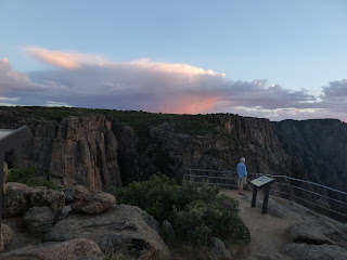
    We drove along the South Rim of the park and looked down into a very narrow, and very deep canyon.  As it goes through the 48 miles of the park the river loses more elevation than the Mississippi does from Itasca to the Gulf of Mexico.  At one point the canyon is so deep that two Empire State Buildings could stand on top of each other in the canyon.  Despite the steep walls, dangerous rapids and sheer cliffs, we saw several guys standing on a rock fishing deep in the canyon.  We never figured out how they got down there, but a fisherman that we met later in the day told us that there are trails down into the canyon.  Yikes!  However, if there is one thing that we have learned on our travels it is that you have to be here to really "see" how very deep this canyon is.  No photograph can give you the perspective of looking so far down to where the thundering Gunnison River flows between the black walls of the canyon.


   For our afternoon adventure we drove to the “East Portal” of the park down a road with a 16% grade.  We drove the little Honda CRV around rock falls and down the perilously steep and twisty road.  We were in first gear most of the way down and still needed the brakes.  Once at the bottom we found a lot of fly fishers, a campground, a dam, and the entry to the diversion tunnel.   It was really fascinating to see an engineering feat from the early 1900’s still in use.

Friday, June 14, 2013

San Juan Scenic Byway

     We are headed to a new National Park that is in the heart of Colorado.  The shortest way to get there from Cortez is by driving a scenic, but steep and winding road through the mountains.  This road is a full loop and we have been on the sections from Silverton to Durango and from Durango to Cortez, pas t Mesa Verde.  The route today takes us along the Dolores River, north to the ski town of Telluride, and then to Ridgeway and Montrose just outside the park.
     In 1859 the gold rush began in the Rocky Mountains.  Soon gold and silver was found in the San Juan area and narrow gauge railroads were put in to move the ore out of the mountains.  Roads, settlers and towns followed, along with farms, ranches, and lumber operations.  The are along the Dolores River, through Rico and into Telluride was heavily forested.  It was great to see big trees again.  We went over the Lizard Head Pass at 10,225 feet and had a great view of the valley but no stopping for pictures on the narrow road.  
     The area around Telluride was as picturesque as a ski area should be, but with a huge amount of development on the hillside.  Lots of new condos going in.  We have never skied here, but understand that the skiing is steep without much beginner or intermediate level runs.  It is a beautiful area, for sure.
   The road took a long downhill run from there, through Ridgeway which is on a big reservoir and has a beautiful state park along the shores.  Like most of the lakes in the area, the reservoir was very low.  Colorado has been in a bad drought for a couple years.  No fires where we are but lots of fire restrictions.  
     The road into the park started in the valley and went straight up.  Our engine did not overheat, but it was really working on the six mile drive up.  We are back into the high desert environment, with mostly scrub oak and pinyon pine around our campsite.  We have arrived on the weekend and the campground is pretty full.  I reserved an electric site months ago so we are able to run the AC if needed.  At least for today it is a out 10 degrees cooler than in Cortez, thank goodness.
     Shortly after we pulled in and settled into our lawn chairs we were visited. Y the local mule deer.  They seem to enjoy the campers and wander around very unafraid.  We are loving being back into a quieter setting with spectacular views.  

Canyons of the Ancients and Hovenweep National Monuments

     We took the road less traveled today in search of some less visited Anasazi ruins.  We drove on the Trail of the Ancients Scenic Byway west and north of Cortez.  The drive took us to the Great Sage Plain which is over 1500 square miles of high plateau interspersed with deep canyons.  There are several rivers that flow through this landscape, so many areas are covered with juniper forest and sagebrush.  This area has the highest density of prehistoric and historic sites in North America.
Lowry Pueblo
      Our main objective for the day was to get to Hovenweep National Monument.  However, I could see on the map something called Lowry Pueblo, and when I checked my smart phone it told me that this was one of the ruins that could be found in the Canyons of the Ancients.  The road went from paved with shoulders, to narrow, old pavement, to wide gravel, to a narrow, bumpy, rocky track.  Then, suddenly, we found a parking lot with several cars, a picnic area, and the ruins of a thousand year old Puebloan village.  No Park Rangers or crowds of kids.  Shortly after we arrived we were the only folks there and could just walk around the old village, smell the sage, and listen to the whispers of the families who lived here.  I loved it.
    We left the Pueblo and drove another 20 miles past fields of alfalfa and herds of goats and sheep.  I could see piles of yellow rock everywhere and assumed that we were seeing parts of ancient ruins along with the modern farm buildings.  Hovenweep is another National Monument and had a fairly new and very nice Visitor Center.  The area that is adjacent to the Visitor Center is called "Little Ruin Canyon" which has a series of round and square towers.  There are many theories about the shape and size of the towers, but no one is sure exactly what they were used for.  They can be found on the perimeter of a canyon along a two mile trail.  The most impressive of the ruins are within 3/4 of a mile.  We were warned to take water by the Ranger who told us that it was 98 degrees and windy in the canyon.
     The first part of the walk was on sidewalk and then became an uneven path up and down some big rocks.  We walked for a while, took some great pictures and then reassessed.  The heat and wind were so extreme that we were gasping for air.  I remembered that there is still a person missing who took a hike into Mesa Verde last Sunday.   We could see most of the buildings from our high point and used the binoculars and zoom lens on the camera to appreciate them.  Then we took a few more pictures and headed back to the shade of the Visitor Center.  We drank a couple quarts of water, ate lunch, and drove on.  I find this a fascinating place.  I have a bit of dusty, spicy smelling sagebrush and some great memories of walking where an ancient people walked.  So cool (or hot).


Thursday, June 13, 2013

Anasazi Heritage Center, Dolores, Colorado

   Anasazi is the Navajo name for a farming people who lived in the Four Corners between AD 1 and AD 1300.  The Anasazi Heritage Center was created during the McPhee Dam and Reservoir project which put thousands of acres of these historic lands under water.  Before the dam was created the largest single archaeological project in the history of the United States, the Dolores Archaeological Program, mapped about 1600 archaeological sites- including hunting camps, shrines, granaries, households and villages- along the Dolores River in the reservoir area.  The Anasazi Heritage Center now houses artifacts from about 120 excavated sites.  The Center also raises awareness of the need to preserve the many sites which still exist across the Canyons of the Ancients National Monument where people can hike to the places where the Puebloan peoples lived and left behind so much evidence of their former homes. 
   A couple videos at the Center emphasized the links that Native Americans have with their ancestors and their history. They say that they “Look back for inspiration.” Unlike many in my culture who look forward.   It was a good reflection of a difference in cultures.  The Puebloan people also asked for respect and appreciation of the land and the home sites of their people.  They pleaded with folks not to move or remove artifacts.  We will be heading out to view some of the many sites tomorrow at Hovenweep.  This was a good stop for us as it brought together information from several trips as we visited sites in Utah, Arizona and New Mexico a couple years ago.  It was a great stop for us.


    We ended the day at the Cortez Cultural Center where we enjoyed some Native American dancing and narrative about the Ute tribes.  The Utes are Plains Indians rather than Anasazi and moved into Colorado during the settlement of areas they had formerly inhabited.  I was interested to see that one of the Native American girls who were dancing was wearing a “Jingle” dress.  I have seen these same dance dresses worn by Ojibwe dancers in Minnesota.  Her father, the narrator, told us that there are now many intertribal dances and competitions which result in the young dancers learning new dances and traditions.  It was a beautiful way to end our day.

Wednesday, June 12, 2013

Cortez, Colorado

     I started the morning by sharing the discovery of a doe and fawn walking through the campground with the three darling little girls who were camped across from us.   The girls were great little campers and stayed very quiet as they watched the deer browse on the oak trees next to our camper.  I am so happy when I see kids learning to appreciate the outdoors.
Prickly Pear cactus in bloom everywhere
    The trip into Cortez took less time than the setup did when we arrived - the town is only ten miles from the park.  We are at Sundance RV Park which is right on Main Street about five blocks from the main part of downtown.  What a change from our lofty (and very quiet) retreat in Mesa Verde.  The campground has some big old trees which provide nice shade, not much grass, and views of the neighborhood and a trailer rental facility.  As city campgrounds go, it is nice and clean and has very friendly staff.
    This is the midpoint in our trip and time for maintenance and shopping.  We found a wonderful cafe, "Once Upon a Sandwich" for lunch.  We have been living on sandwiches at rest stops so I had an amazing salad with beets, blue cheese, dried cranberries and chicken. Yum.  Then, we went to a delightful quilt shop, Cortez Quilt Company, just across the street.  Even Rick was impressed with the many great quilts on display.  Of course, I found some fabric and a book that I had to have, of course.
    After supporting the local shops we stopped at the nearby Walmart for some basic supplies and went back to the camper to do laundry.  I was happy to find a cool, clean, well functioning laundry room and got the onerous task of laundry on the road done in only two hours.  We caught up on news, blogs, and other electronic chores.  We were wondering if the search in the park yesterday for missing hikers was successful.  We saw a helicopter flying low over the Spruce Tree area and dozens of searchers heading out.  It is so hot and there is no water.  It would not take long for someone to be in big trouble if they were lost.  But there was no word on the news.   It is probably a pretty common occurrence.
     After dinner, when the cool evening breeze began to slide through the campground, we sat outside in the falling dusk and talked with our new neighbors.  An ordinary day of life on the road.

Monday, June 10, 2013

Spruce Tree House, Mesa Verde

     We got ourselves moving early today so that we could take the hike down to Spruce Tree House.  This cliff dwelling is one of the largest in the park and may have had 60 to 80 people living in about 130 rooms which are situated under a huge sandstone overhang.  It faces west and in the afternoon the trail down and the dwelling are both in full sun.  This morning it was in full shade.  We walked down slowly and enjoyed the many shrubs and wildflowers along the trail.  Once we reached the village we were in cool shade and could enjoy the amazing buildings which have stood here since the 1200's.  It was very quiet and I could really imagine what it would have been like to live in this community.
    A couple of kids were exploring the site and had dozens of questions.  They wanted to walk around the buildings.  The kids asked if they could climb into a tower. One Ranger asked another,"Did you clear out all the snakes this morning?"  "Yes," she answered, "I think that I got them all out."  The kids went in, carefully.  Rangers said that they have many options for encouraging kids to take it easy on the fragile ruins.
    We left Spruce Tree and drove out to Wetherill Mesa which is much less visited.  It is about a 20 mile drive up and down hills to get to up onto the high section of this mesa.  A tram took us out to overlooks where we could see several more huge cliff dwellings.  Long House is another large site which has tours.  This tour requires a hike down 130 feet and then climbing down two fifteen foot ladders to the site.  Once you are down, you have to get back up again.  We looked at it from afar as it was in the 90's again this afternoon.  I keep wondering why the people settled so high in such a difficult place to get to.
Proof that I made the hike down to the dwelling
    Usually we like to have breakfast or lunch at the dining room of the national park lodge.  However, Far View lodge is mostly a set of 1960 era motel buildings.  Nothing very impressive.  We ate at the Far View Terrace cafeteria and I had some delicious Navajo tacos.  Yum.
    The hiking and the heat wiped us out so we went back to relax at the camper.  It was so hot, even under the nice shady oaks that we retreated inside and turned on our generator for an hour of air conditioning.  It is so nice to be able to do this - even when we had the generator on the 5th Wheel we couldn't run the air.  By dinner time the breeze came up and we went out again to enjoy the evening.  Lots of Germans in the campground driving rented RV's.  Mesa Verde must be big on the list of places to see for international visitors.  There was a bus load of Japanese folks and another of French at the Visitor Center.  We think about how immense this empty desert must seem to folks who live in lands that are so heavily populated.

Sunday, June 9, 2013

Mesa Verde National Park

We are in a wonderful and mysterious place – the high desert of Mesa Verde.  We are walking and living where the Ancestral Pueblo people lived their lives.  There are signs of inhabitants at this place from 550 A.D.  The cliff houses are from around 1100 A.D.  It is so quiet – very few sounds of modern civilization interfere with the sounds of wind and birds.  The spirit of the ancient people who lived here is very alive.
     When we arrived at the new Visitor C
enter the temperature was already 87 and was over 90 by the time we reached the campground.  The forest fire danger is high in these very hot, dry conditions, but so far Colorado has only had a couple small fires.  There is still a lot of green here on the mesa.  We stopped to look at the new Visitor Center which was just opened.  It is beautiful and very reflective in architecture and art of the natural environment and the native people of this area.  We enjoyed the sculpture and paintings as much as the exhibits.
   The Visitor Center is on the flats below the mesa.  To get to the campground we had to drive four miles high up onto the lower part of the mesa.  We learned at the campground office that we could just drive around and pick out a camp site that we liked.  There are almost 400 sites and we were lucky to find one tucked into the shade of some scrubby oak trees.  The back end of the campsite has a lovely little alcove under the trees which is completely shaded.  We set up our lawn chairs there and had lunch.  A young deer wandered through the brush behind our campground.

   There are many cliff dwellings within the park.  Several have Ranger led tours to them.  We took one of these tours several years ago when we visited so this time we are doing more adventuring on our own.  We drove the circle tour around one of the areas.  It was so hot and dry by late afternoon it just took my breath away.  So after a couple hours we went back to our leafy bower and read.  The breeze came up and by suppertime the temperatures were already dropping.   By 8:30 the sun had dropped behind the mountains and so did the temperatures.  After a day of 90 degree temps we had to put on a light fleece.  The campground is about 25% full now and everyone is outside enjoying the cooling evening.  It is a magical place.  

Saturday, June 8, 2013

Durango - Silverton Narrow Gauge Railway

     We took our third train trip today.  It was on the most publicized of the many train rides in Colorado.  The trip takes four hours and goes between the town of Durango at 6500 feet and the town of Silverton at 9500 feet. Most of the ride follows the Animas River Canyon - the river which runs alongside our campground.
    The railway was built by the Denver and Rio Grande Railroad to haul silver and gold ore from around Silverton.  We could see the piles of tailings from the mining operations all over the mountains surrounding Silverton.  The 45 miles of track was laid in less than a year.  During the winter the workers were housed in log cabins that were only a few logs high.  The houses were so cold and uncomfortable that the workers who had families dug holes in the mountain for their families, because a cave was much warmer. It must have been miserable since just the 8000' altitude is a challenge.  I thought of them as we rode the rails on a warm, sunny day. 
Riding along the very edge of the rushing river
    The ride took four hours and then we spent a couple hours having lunch and wandering around the little town of Silverton.  I am not sure that the town would exist without the three trains a day that dump a couple hundred folks in town.  Rick had chatted with another train fan in the campground and found out which cafe could serve a quick meal so we wouldn't have to worry about catching our bus back to town.  Grumpy's was the spot and the burgers were delicious!
   The Durango Silverton comes up all the time when folks talk about amazing rail rides.  The scenery was just amazing with the river rushing through narrow canyons and the flattening out into ribbons along the valley floor.  The steam engines are beautifully restored, as are the rail cars.  But if you have real interest in old rail roads, the Cumbres and Toltec ride was more interesting with many big curves, trestles, huge gain in altitude and variety of terrain that it passes through.  On the other hand, the ride is longer and the town of Antonito offers little in sightseeing opportunities.  I hope that you get to take at least one of these trips if you love the sound of the whistle and the thunder of the rails.
    Back in Durango the weather had heated up over 90, so we hurried back to our resort on the river with a nice breeze.  I caught up with friends and family on the phone.  Tomorrow we head to Mesa Verde which will have no phone or Internet access.

A Day in Durango

     Today was a resting day for us.  Time to recharge and take a little time off.  We awoke to a beautiful sunshiny day and had a grand, slow breakfast.  Since we have Internet here we were even able to read the news from home on the Star Tribune - Rick saw that a woman in Aitkin near our cabin was attacked by a bear. Wow!
    As we ate breakfast we heard the first of three Durango/Silverton trains go by.  Our campground is located in the canyon that the train runs through on its way to Silverton.  We are booked on the train tomorrow.
    Durango is a center for artists and Southwest crafts.  The last time we were in the area we looked at some beautiful Navajo rugs.  I really wanted one and decided to do some research before we looked at them this trip.  We went to the Toh-Atin Gallery and pulled out a huge pile of beautiful rugs. Hand woven and dyed wool rugs.  Each community has its own style of weaving and designs.  The gallery staff told us a lot about the various styles and how the rugs were woven. I was immediately drawn to some styles so we pulled them out and draped rugs all around the floor.  I found a favorite fairly quickly.  It was created in the Teec Nos Pos community which is just south of Durango.   It is a vintage rug from around  1930/40 and has a history.  I looked at many of the others, but this one just spoke to me and I am excited to hang it in my house.  We rarely buy things as we travel - the pictures and experiences are so meaningful to me.  But this trip I will bring home the hand work of a Southwest artist.
    We also took a tour of the Durango Arts Center which had a focus on the Ute tribal art.  Beautiful beading and pottery.  Then lunch at the Steamworks Brewing Company where we threw caution to the winds and had a beer along with our fish and chips lunch.  The beer took care of the afternoon for us as we napped and read in our lawn chairs next to the river.  Then I had to take out my rug and admire it in the sunshine and spend time researching the weaving community on the Internet. So interesting.
Great day.

Friday, June 7, 2013

Two Passes into Durango

     We never know what we are going to see along the road.  We were prepared for some very high mountain views today as we drove over two high passes on the way to Durango.  We got to the top of the first pass without difficulty.  We were on a quiet highway with a low speed limit so the fact that we are a bit slow going up the steep grade is no problem - there was no impatient traffic behind us.  Then, as we headed to the next pass, we saw that traffic was stopped.  Coming down the highway towards us was a flock of sheep being herded to their summer pasture.  They flowed across the whole highway and up the banks along the road.  Lots of lambs baa baa baaing as they tried to locate their moms.  I fumbled with my camera, but finally got a couple shots.  What a fun roadblock!
Cumbres Pass sheep
   There is a lot of water in the high altitudes.  Everything is really green and there is plenty of water in the streams and gullies.  We have seen some wildflowers and some snow.  I think that it is still early at 10,000 feet for the flowers to be fully blooming although there is one that I am trying to get a picture of so that I can identify it.  I am also happy to see that the terrible spruce beetle that has killed so much of the pines in the northern Colorado mountain slopes has not hit here and the huge pines are beautiful.  The slopes are also covered with quaking aspens which are just starting to leaf out - waves of fresh, pale green.  A nice contrast to the dark pines.
   We are staying at the Durango Riverside Resort for the next few days.  The resort is on the Animas River which runs swiftly along in front of our RV about 50 feet away.  The days are warm and getting warmer, but the nights are still in the low 50's and the sun drops behind the Rocky Mountains pretty early which cools things off really quickly.  We are approaching the weekend and school seems to be out so the campground is just filled with kids.  I miss my grandsons.  They would have fun here.  I am happy to have phone service back and a sewer connection for a couple days.  We need to do some house cleaning.  It has been really dusty
   Tomorrow we have a day of relaxing.  I can't wait.  The swimming pool is calling my name.

Thursday, June 6, 2013

Cumbres and Toltec Scenic Railroad, Antonito, Colorado

     There is nothing like the sound of a steam engine blowing its whistle.  It sends chills up my spine and makes me think of travels to wonderful and exotic places.  The Cumbres and Toltec is the longest and highest narrow gauge railroad in the U.S.  It is a well preserved section of the narrow gauge part of   the Denver & Rio Grand Railway.  This part of the railway was made narrow gauge because it needed to make some pretty tight turns in the mountains.  It follows the Toltec Gorge and goes over the Cumbres Pass at over 10,000 feet. The line passes through Rio Grande and Carson National Forests and has some really beautiful scenery along with the historic charm.
    This was a quiet day for train riders and we had a car all to ourselves which was pretty nice.  We could move from one seat to another to get the best view and stand up and take pictures out of the windows without getting into anyone's way.  The cars had huge windows that opened wide although the ashes and smoke from the steam engine created quite a hazard at times so we didn't open all the windows.
Our trusty engine for the day
   There was a completely open "gondola" car that Rick went back to for even better pictures.  He came back with big chunks of ash in his hair so I passed on that thrill.  We got a map of the route so that we could anticipate exciting curves, tunnels, trestles and towns.  At times we were on very narrow  ledges where we could see straight down for hundreds of feet.  At other times we were so hemmed in by rocky walls that we had to be careful when we looked out the window so the rocks wouldn't snag our camera.
   It was a 64 mile trip, and the train went about 10 miles an hour so we were on it all day.  We stopped at a toll station on the old toll road from Conejos to Chama in Osier and had lunch.  It was a delicious, cafeteria style turkey meal with all the fixens.  Yum.  Then back on the train for the higher, steeper half of the trip to Chama.  We got near the highway in a few spots and saw dozens of folks gathered to take pictures.  The engineer obliged by sounding the whistle.
  Late in the afternoon we arrived in Chama and hopped on a cumfy, air conditioned bus to take us back to Antonito.  It was a nice change as the train ride was pretty bumpy and was hot by late afternoon.  All in all it was a great experience. Our car was just behind the engine so Rick got plenty of time to watch the engine release steam and get filled with more water.  A volunteer talked about how the train worked and told us some of the history of the rail line.
   This was our second choice of train rides to take (Durango Silverton was the first) but we had a terrific time and are so happy that we had the chance to take this ride.  We will compare it with the Durango ride in a couple days.

Wednesday, June 5, 2013

Ponderosa Campground, Antonito, Colorado

     I usually start planning trips months before we go on the road.  This trip was prompted by Rick's love of trains and the fact that Colorado has some great and interesting historic trains to ride.  Today we left the Great Sand Dunes on a calm morning and headed south to the small town of Antonito.  It is one end point of the Cumbres & Toltec Scenic Railway that we will be riding on tomorrow.
   I knew that the train ride goes all day so I wanted to find a campground in Antonito so that we would not have a long drive in the early morning to get to the train.  One of us is not a morning person.  I found a highly reviewed campground which was described as being "on a river" in Antonito and was happy when I called for a reservation to discover that we could get a site right on the river.
    I plugged the address into our GPS today and was surprised at the distance we had to drive.  I was thinking about 55 miles, but the GPS showed 80.  Without Internet service or phone service in the park I was limited to looking at the map which verified to me that Antonito was only about 55 miles south.  We started driving and figured that we would get more information when we found phone service.  I am so dependent (I was looking for another word but dependent is exactly right) on my phone to help me with trip planning along the way.
The view from our camper
   I discovered that the campground is actually 20 miles outside of Antonito, despite the mailing address.  I was grumpy.  Now we will have to drive 20 miles back to get on the train and then another 20 miles to get back to the campground after the train ride. Grump, grump, grump.  We got to Antonito and found it to be a dusty, weather beaten, little plains town without trees, green grass, pleasant scenery - nothing.  So I wasn't so sorry that we were not staying in town.  We drove the additional 20 miles and found ourselves in the mountains among tall pines, rushing water, and green grass.  Ahhh!
    The campground is beautiful.  We are parked under huge pines with a trout stream just outside our door.  The campground owner told us that an air horn will sound if there is a flash flood.  We will have to hop in the car and drive like crazy.  However, clear blue skies tonight so I am not going to worry.  We sat in our lawn chairs all afternoon, listening to the water, watching the fisherfolk, and reading in the sunshine.  I am flushed with a tinge of sun and so relaxed I can hardly keep my eyes open.
    So the message of the story is:  don't get grumpy until I am  sure there is something to get grumpy about.  I will sleep well tonight to the sound of a mountain stream.

Tuesday, June 4, 2013

Great Sand Dunes National Park, Mosca, Colorado

    We drove over our first high pass on this trip, just outside of Walsenburg, Colorado.  Our diesel truck pulling the big 5th Wheel did better going up steep grades, but we made it just fine and gained another 4000 feet in altitude.  The campground at the Great Sand Dunes is at 8000 feet - gasp!  We saw the "Spanish Peaks" as we drew closer to the park - stately, snow topped mountains.  But we were driving on a high plain - mostly sagebrush and cactus.  There were big vortexes of sand and dirt stirred up by the wind and once again we were buffeted around on the highway.  However, it was a short drive and we were in the park before lunch.
   I had reserved a campsite months ago and was delighted to see that it was as nice as it looked in the pictures on Reserve America.  It had all the good things: a great view,shade, a nice picnic table and grill, and plenty of space for the RV and car.  As we settled in to eat lunch we were amazed at the quiet beauty.  Lots of birds and small mammals in the brush.  It was so fun to stay in the park now that we have a smaller camper - our 5th Wheel would never have fit.
     The dunes are a natural wonder - the tallest in North America.  Most of the sand comes from the San Juan Mountains.  They back up to the Sangre de Cristo Mountains and a couple creeks run down out of these mountains and across the bottom of the dunes.  It makes for a great, sandy play area and lots of kids were building castles and wading in the water which was only a couple inches deep today.  Other folks bring dune sleds and climb high onto the hills and slide down.  It seems like a lot of work at 8000 feet, but the younger crowd was having a great time.
     We put out our lawn chairs and sat in the warm sunshine enjoying the view until we were chased inside by a sandstorm.  I wasn't quick enough to close windows in the RV and we have gritty counters and floors everywhere.  Our windows are pretty much covered with dust as well.  We ate our dinner indoors away from the flying sand.
     Soon after supper the sun came back out and the wind died.  We hauled out the lawn chairs for an evening campfire.  It was a peaceful evening with a great sunset as the temps dropped down into the 40's.


Sunday, June 2, 2013

Pikes Peak Cog Railroad, Colorado Springs

     Such a fun day!  We started with an "all you can eat" pancake breakfast at the KOA Cafe.  Good pancakes, great coffee and huge sausage patties served at an outdoor cafe under a clear blue sky.  I love outdoor dining - even pancakes.
     I called for a reservation on the railroad.  We could get on the noon train for a three hour ride.  We had a stack of maps and brochures for the area and looked at what else we would do.  Emily Buoen suggested lunch at a huge old hotel, Broadmoor.  However, it is Sunday, brunch at the hotel was $55 a head, and we were supposed to be wear "dressy casual" clothing.  Well, maybe another time.  We are "camping casual" , but not dressy.
At the top of Pike's Peak
    Instead of going to the Broadmoor, I found a spot described as a scenic drive near Bear Creek Park.  The road was narrow and winding going into the foothills past some amazing homes that were perched on the rocks overlooking Colorado Springs.  Our drive then took us through Manitou Springs - a delightful historic town with many restaurants, shops and pubs.  It was founded as a scenic health resort with mineral springs.  The springs are still there and can be enjoyed for free.
   Pikes Peak is over 14,000 feet high and named for Zebulon Pike, an early explorer of the Southwest. He discovered it, but did not get to the top of it.  The railway to the top of Pikes Peak was built by Zalmon Simmons, creator of Simmons Beautyrest Mattress in 1809. It is the highest railroad in the U.S. and the highest cog railroad in the world.  The cars have huge windows for good viewing on the way up the mountain.  They don't just "ride" the rails, but are attached to the rails so the train is pulled up a 25% grade which couldn't be done with a normal rail car.  The original engines were steam, but now the train is powered by diesel engines.  We were assured that the ride was very safe.
   The train gains almost 8,000 feet in altitude and goes through many different types of terrain, plants and animals.  The temperature drops over 30 degrees.  We started in shirt sleeves and put on jackets and sweatshirts by the time we got to the top.  On this very clear and sunny day we could see over 150 miles.  The views were just amazing.  Wow, you must do this if you get to Colorado!
   So, with one train ride behind us, we headed back to the RV to get ready for a stay in the Great Sand Dunes National Park.  No power or Internet for a day or so.  Then we will be back online!
   

Colorado Springs

     The wind blew like crazy all night long; rattling the camper and buffeting us around like we were at sea.  It only stopped for a bit about five in the morning.  The lack of noise and the singing of the birds woke me up.  I plugged in our little heater because it was only 45 in the camper, and then went back to bed.   By the time we got up for good, the wind was blowing strong again. I think that this could have been a beautiful campground, but we mostly saw huge waves and branches whipping in the wind.
Colorado Rest Stop Picnic Shelter
    Back on the road it was not as windy and very soon we turned south and crossed into "Colorful Colorado."  I-76 followed the South Platte River and took us through acres of rangeland full of beef cattle and oil wells.  We were  glad that we filled up on gas before we hit this lonely part of the road.  Mile after mile of wide open spaces under a partly cloudy sky and very little traffic.  This is traveling that I love.
    We stopped for lunch outside Fort Morgan which was established to protect travelers
along the Overland Trail.  From there folks headed north to Oregon and south to Denver and California.  As we drove over a big hill and saw the line of huge, snowcapped mountains before us we could understand why it this area of the trail was a dividing point.  No one in a covered wagon was going to go OVER the mountains at this point, they had to find a lower pass.  I always look at the Rockies when we first see them and think how close they appear - as though we will be there in another ten miles.  Perhaps the first explorers thought this too and then found how really high those peaks are.  It must have been both exciting and discouraging to the folks on the wagon trains.  I would like to read some journals of travelers in this area.
   By mid afternoon we were set up in a nice KOA campgound, with our awning out, lawnchairs underneath, and some Big Ginger drinks in our hands.  It is warm, sunny and NOT WINDY.  We fired up the barbecue for dinner and then wandered over to the KOA Cafe for some ice cream cones and a little socializing around a big bonfire.  Temps are dropping to the 40's each night despite the warm days.  Perfect camping weather!


Friday, May 31, 2013

Lake Ogallala, Nebraska

    We awoke to a clear blue sky and a slight breeze.  The weather report was for windy conditions later in the day so we rushed a bit to get going by 8:30.  We are not much for long drives, but today it worked out to be 400 miles between stops.  I don't know what I was thinking when I planned these two stops on this trip.
    We had an easy drive through Council Bluffs and Omaha.  I wondered if there was a council on the bluff that gave it its name and sure enough:  the Lewis and Clark expedition had a big meeting with the Otoe tribe in 1804 on the bluffs above the Missouri River. The town was the starting point for the Mormon Trail and was a major outfitting point on the Missouri for the Emigrant Trail and Pike's Peak Gold Rush.
    As we continued on I-80 we began to follow along the Platte River and the Great Platte River Road which was used by settlers going to Oregon and California as well as by riders on the Pony Express. Rick thought that the Pony Express was in business for only five years, but actually ran only 18 months and then the railroad went through to California.  Anyway, the Platte follows a wide, flat valley which was just perfect for the wind.  By lunch time it had gone from a breeze to a blow - we ate lunch  inside again today.
    After lunch, with 200 miles yet to go, we found ourselves driving almost directly into the wind and often slipping into third gear as we fought to keep our momentum going.  Strong gusts blew us off to the side.  The wind went from a blow to a gale.  We finally
The huge earth dam keeping Lake McConaughy from our campground
got to the town of Ogallala and were happy that we were almost to our campground when the GPS became confused and sent us all around town.  We pulled over and brought up Google Maps on my phone and followed the map out of town towards Lake McConaughy which is a 22 mile long reservoir on the North Platte River.  The lake is much smaller at the moment after a few years of drought, but is still quite a sight with wonderful sand beaches all along its shores.
    We eventually got to our campground on a little lake just on the other side of the huge earth dam, Lake Ogallala.  The campground has dozens of old cottonwood trees and is beautiful.  However, the wind is blowing so hard we have to hold on to our door with two hands to keep it from being torn off the hinges.  I feel sorry for the folks who have come to this pretty place for a fun weekend of campfires and boating.  Mostly folks are huddled on the downwind side of their campers and trying to hold on to their hats.
   Every day is a new adventure on the road.  Tomorrow our drive to Colorado Springs is only half as long as the drive today and hopefully the wind will have died down.

Thursday, May 30, 2013

Prairie Rose State Park, Harlan, Iowa

     We are in a lovely Iowa State Park about eight miles off I-80.  It is a perfect summer evening.  There are only a half dozen other campers and the only sounds are of the wind and the meadowlarks.  The lake here is very low due to last year's drought so there is no boating or swimming yet, but all the rivers and fields that we drove by were full of water so I expect that the lake will soon be full again as well.
    We had our usual slow first day start as we put all the cold food into the refrigerator and all the last minute stuff into the cab.  As I was putting stuff away I wanted to take a picture and couldn't find my camera.  I looked through the usual spots on the camper and could only remember having it at the cabin last weekend.  Just now when I set up my computer I found it in the computer bag.  Yeah!
    The Weather Channel had dire predictions for rain and storms.  We left home in humid sunshine and strong south headwinds which greatly increased our fuel consumption.  As the day progressed we had some light rain, big clouds and more strong winds.  It is hard driving a big rig while towing a car when the wind is bouncing you all over the highway.  Our drive was a little over 300 miles and we made it to our stop for the night by 4:15.  Time for a glass of wine before dinner.YES!
    I like to read all the historical markers at wayside rests.  Today I learned about all the vegetable canning factories in Minnesota as well as the world's first carp canning factory built in Mankato in 1946.  I guess I can't think of anything much yukkier than canned carp.  I wonder if they are still in business.  I guess I will have to do some research.
   Now our NOAA radio tells us that there are only some very isolated thunderstorms expected and then sun tomorrow - with more wind.  We will be heading across the flats of Nebraska along the Platte River so I expect that we will fight the winds again.  I am happy to hear that most of the threat for tornados is gone, but we checked out the brick bathhouse down the road as our only shelter here in the park.  Only once in our many years of camping have we had to run to shelter - that was in Georgia.
   I am happy as always to be back on the road.  We are so lucky to still have our health and time to spend doing what we enjoy.

Monday, May 13, 2013

Colorado, Here We Come

   In a couple weeks we are going to take the Colorado Train Trip that we planned for last year.  The many forest fires in Colorado and the timing of Jennifer's transplant changed our trip last year to a fall trip to the Blue Ridge Mountains.
    When we took our trip to the Western National Parks in 2008 we thought about taking the Cumbres and Toltec railroad trip into the mountains near Alamosa, Colorado.  But early snowfalls chased us out of the high elevations and we skipped that part of the trip.
   Now I have found a couple other train rides - An all day ride out of Durango on the Durango/Silverton, and some shorter rides in Colorado Springs and Georgetown.  Rick loves trains and has been working on a large n-gauge train layout in our basement since we moved into this house.  The rides will take us high into the mountains into areas without roads.  It should be beautiful and hopefully, without forest fires.
   On our last trip through this area we were pulling our big 5th wheel.  Now that we have a more maneuverable rig we are planning to stay in some National Park sites that we couldn't get into last time - at Great Sand Dunes National Park and will also be staying in Mesa Verde National Park and the Black Canyon of the Gunnison National Park.  Lots of places with no Internet or electricity.  This will definitely impact my timely blogging.
    During the winter this year I have edited my blogs (and missed a lot of errors according to Rick) and put five years of travel memories into a book for me and my kids.  I love to look back at where we have been and relive our adventures.  I was worried that the electronic version of these trips will someday evaporate so it seemed like time to make it more permanent on paper.
    I look forward to sharing this new trip with you.

Wednesday, March 20, 2013

From flip flops to mukluks

    We slept with the windows wide open on our last night on Crescent Beach.  It was warm overnight and a bit humid.  The humidity and light rain has helped bring a little more green to this very dry area.  We have heard many reports of brush fires and smelled smoke nearby this morning.  So much of the land here is marsh and that it seems odd to hear so many fire warnings, but there has been a lot of drought everywhere this year.
    We shook some of the sand out of our clothes, shoes, books and towels so that we could pack them up.  I just got into the pace of stepping outside with only a t-shirt and shorts on.  Every time we take a winter vacation we wish that we had stayed longer.  Rick's love of downhill skiing and our sweet grandchildren keep us from spending the winter away from home, but I will definitely plan a longer warm weather break next year.
   We enjoyed the great historical sight seeing in St. Augustine and found the prices for our rental car, nice condo on the beach, and meals to be cheaper in this area than most other warm weather spots that we have visited.  The beach was amazing - it goes on forever and has wonderful, soft clean sand.  However, this IS the Atlantic and the water was pretty chilly in March.  It is a very laid back area and has a big population of retired folks.  We did not find fancy restaurants, but found some really wonderful casual places to eat with great views of the water.
   We spent a lot of the time comparing this area to Sanibel Island on the Florida Gulf coast and to Hawaii.  We want to go back to both of those areas and probably won't be back to Crescent Beach  unless something else draws us here.  So it was great to visit a city that I missed on previous travels, but now there are other spots I have yet to visit - Key West perhaps.
   Our trip home was uneventful (a good thing to say about plane travel these days) except that I got a notice from Delta that they had lost my luggage as I drove home with luggage in the trunk.  I am not sure WHAT they did to my luggage, but it seems fine.  We got back just in time to help Carter celebrate his big 6th birthday at Old Country Buffet.  Most kids would be excited about endless mashed potatoes and mac and cheese.  Carter was excited about a huge selection of fruits, veggies, jello, and three big slices of ham.  This boy is into power food!
   It is cold outside, but I am happy to be home to get hugs from my first grandson.  Goodbye warm weather!

Monday, March 18, 2013

Dow Historic Houses, St. Augustine

It rained last night and we woke to gray skies. Florida is having a lot of fires so rain was good but we didn't want to stay inside on our last day in the sunshine state. By the time we got in the car the clouds were thinning so we decided to do more sightseeing in old St. Augustine. One of the areas that we passed on our electric car tour of the city was the Dow Museum of Historic Houses. It is made up of nine historic homes, dating from 1790 to 1910, which are all located within a single city block. Some of the homes could be toured and displayed items from Kenneth Worcester Dow's collections. The property highlights both St. Augustine and Florida history. The grounds were a rambling collection of old gardens, courtyards and porches. There was a general store from 1899, a Spanish style pink stucco house from 1790 and a couple of formal Victorian houses from the early 1900's. We walked around thinking of what a fascinating place it must have been to live in.
We finished our tour and walked around the neighborhood on very narrow, crooked streets paved with bricks. It is difficult to drive in this area, but great for walking and admiring the variety of architecture. The sun was out and downtown was really getting hot so we had some lunch and drove back to our condo for an afternoon on the beach. There were lots of folks enjoying the smooth white sand and shallow sloping beach. Lots of guys who were surf fishing too, but I never saw them pull anything in. I waded in the water looking for shells and enjoying the cool ocean. We have quite the pile of sand outside our door from our shoes and towels. I can't believe that we will be back to snow tomorrow.
Dinner was at a restaurant out on the salt marsh. The houses nearby had docks that went on forever. Maintenance on them must be a real drag, but it is the only way to get out to water deep enough to float a boat. We had a great view of all the birds soaring over the marsh looking for fish. Why are we going home?


Sunday, March 17, 2013

Blue Springs State Park manatees

40,000 bikers headed home today from the St. Augustine Bike Week - sort of a senior citizen version of the Sturgis Rally. We saw many of them on the road pulling trailèrs full of big, shiny motorcycles. We were driving to Blue Springs State Park where dozens of huge manatees congregate in the 72 degree water during the cold winter months.
Manatees are huge mammals with very mild personalities who are being killed in high numbers in Florida by being cut by boat propellers. They can't live in really cold water. A very clear, shallow stream flows from a hot spring in the park to the St. John's River. The manatees move from the main part of the river to the warm pools when the river gets cold during the winter. A boardwalk runs along the stream with overlooks so that everyone can enjoy a good view of the huge, slow moving beasts. Alligators, turtles and birds all live alongside the manatees who are too big for the alligators to bother. The water is so clear that we could see some huge Florida gar and bass as well, but no fishing is allowed in this protected area.
We enjoyed watching the. Manatee and then stepped aboard a big pontoon boat for a tour of the backwater areas of the river. We got a good history of the area and saw a lot of the "real" Florida - floating bogs, alligators, Sandhills cranes, great blue herons, anhingas, coots, egrets, and osprey. Except for the alligators, cypress and palm trees, we sometimes felt like we were in the channel to west lake at the cabin during the two hour tour. We really enjoyed it. The park is located about a half hour from Orlando and would be a great side trip for visitors to the Disney version of Florida.
We saw our first clouds over the ocean this evening and are expecting rain tonight which is disappointing for our last day tomorrow but so much better than snow, right?


Matanzas Fort and Washington Garden

The warm weather has come back to Florida and we are loving it. I am sitting on my balcony watching sailboats and pelicans on the ocean. I have a glass of wine, sandy feet, and a warm breeze on my face. Ahhhh!
Today we visited the smallest of all of the Spanish forts: Fort Matanzas which was built in 1740 when it was no longer the French, but rather the British who were a threat to the Spanish Florida colony. Whoever controlled Florida controlled the rich shipping lanes coming from the Spanish Caribbean. Florida Governor Montiano knew the British would continue to try to conquer Florida and would most likely attempt to come through the unguarded inlet at Matanzas. So, he ordered a fort to be built to guard these southern approaches-- Fort Matanzas. The fort is on Rattlesnake Island in the Matanzas River. The National Park Service runs free pontoon boat shuttles to the island and then an interpreter dressed as a Spanish officer talked about the political implications of the fort. Florida was eventually sold to the Americans for a penny an acre. It is pretty swampy land, but had some highly important seaports. A good buy
It was a perfect day to be out on the water - sunny, breezy and not hot. We were finished at this small park by lunchtime and decided just to drive south along the coast until we found someplace to eat our picnic lunch. We soon got to Washington Oaks Garden State Park. This beautiful parcel of land used to be the winter home for a distant relative of President George Washington. The gardens were established by Louise and Owen Young who purchased the land in 1936 and built a winter retirement home. They named it Washington Oaks and there are many, huge live oaks trees on the property. I just love these curvy, sprawling trees. They were used to make support braces in old ships because the grain of the lumber was already curved. In 1965, most of the property was donated to the State. It is early for most of the roses in the rose garden but we enjoyed taking a walk along the nature trail and touring the relatively small house built on the Matànzas River. It cost us $5 to get into the park - cheap day for us today.
This evening we looked on TripAdvisor for another dinner spot and went to a truly tiny Italian family run restaurant which makes everything from scratch. I could hear the cook pounding my veal cutlet as I ate some wonderful bread and eggplant caponata. Yummy. I tried to save room for the key lime pie we brought home for desert. Only two more days. Sigh.